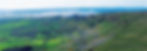
Professional Drone Surveys Across Northern Ireland
About Clearview Solutions
Welcome to Clearview Solutions, where we specialise in delivering accurate, efficient, and reliable drone surveys across Northern Ireland.
Our expert team ensures every project is undertaken with the highest level of professionalism, providing the aerial data you need for informed decision-making — whether for project planning, progress monitoring, compliance, or asset management.
Professional & Certified
Commercially insured, GVC and A2 CofC-certified, we operate under CAA PDRA01 Operational Authorisation.
This ensures every flight meets the highest safety and regulatory standards.
High-Accuracy Data
Combining technical expertise with industry-leading RTK drone systems, we deliver:
-
High-resolution imagery
-
Detailed orthomosaic mapping
-
3D terrain models
-
Structural and asset inspection data
Our workflow provides the precision required for both technical analysis and project documentation.
Supporting Every Sector
From construction sites to renewable energy assets, Clearview Solutions provides actionable aerial insights that help you work smarter, faster, and with complete confidence.